“Why is it called Gulf Hagas?”
This is the question I forgot to ask the range guides when they quietly snuck up behind us as we stood at the 2nd of two water crossings.
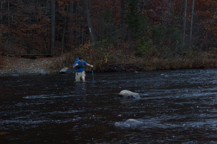
I can be forgiven for this oversight, because for the last 5 minutes, I’d been standing at the water’s edge trying to figure out a way to get across that didn’t involve a) completely soaking my feet or b) falling into the rushing water. My hiking partner had already successfully leapt, gazelle-like, across the water to try to set up his camera for a picture. And, he had also already leapt back to my side, but that attempt was not, ahem, as successful as the first. Luckily, he was fine, if a little soggy.
Give that his legs are longer and his courage greater than mine, this wasn’t boding well for my plan to cross without mishap.
Anyway, as I was pondering all of this, the range guides appeared behind us, and began a gentle interrogation to be sure we knew what we were getting into with the Gulf Hagas trail.
- Did we understand that it had rained recently? Given that it still was raining, this seemed obvious.
- Did we know that the rocks were going to be slippery? See previous note about the rain; check.
- Did we know there was a flat way to come back after we’d done the Rim Trail? Yes, and I was delighted about that fact.
- Did we have headlamps? (It’s worth noting that it was 11am when she asked this.) Yes, of course, we replied, and got an approving nod and a “smart”, which made me feel irrationally superior to pretty much everyone else in the world.
After the interrogation ended, in the way of smart outdoor safety people, one of the guides seemed to clue in that I was struggling to figure out how to get across and offered up a solution that gave me permission to be less gazelle-like than my friend. So I took off my boots, donned my water shoes for the 2nd time in as many miles, headed a few feet upstream, and waded across without incident. And then we set out on the Appalachian Trail, which led us eventually to the Gulf Hagas Rim Trail.
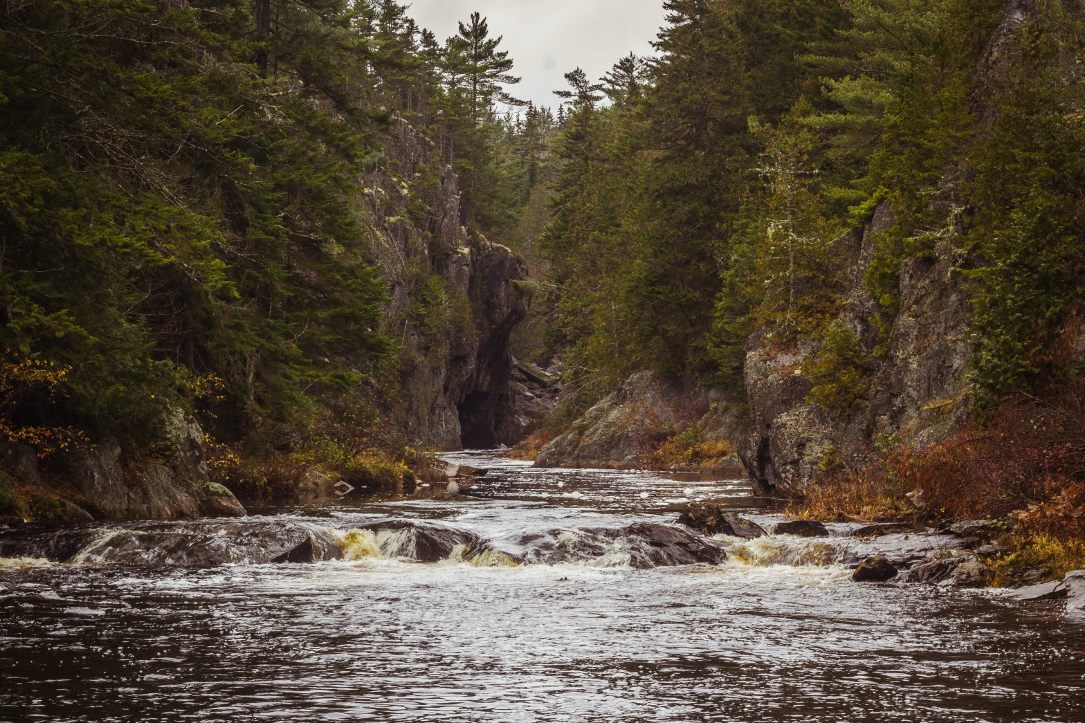
Backing up a bit, here are the basics on the Gulf Hagas hike. This map lays it out nicely, too. We stayed in Greenville, Maine, aka way-the-hell-up-there, and the trailheads (there are two), were about 40 minutes away by long dirt road. The hike can be anywhere from 8.5 to 9 miles roundtrip, depending on where you start (you can also make shorter loops out of the trip, but I won’t be discussing those here). There are two trailheads: East and West. If you start at the East, as we did, you’ll have to ford two water crossings twice (on the way out and the way back). At the biggest crossing, I’m told the water can be waist high at times; for us, it was just over knee-deep at the deepest point. And it was cold and the current was fairly strong. I wore my water shoes and that helped, but even with them, the rocks were slippery. My friend did the crossings barefoot, which I’m pretty sure he wouldn’t recommend if it can be avoided.
However, it felt pretty adventuresome to be “fording” a river, so don’t let the cold and the wet dissuade you. Just bring an extra pair of socks in case, like me, you accidentally drop your first pair into the water. Next, you’ll cross a smaller portion of the river – this is where I took my shoes off for a 2nd time to get across.
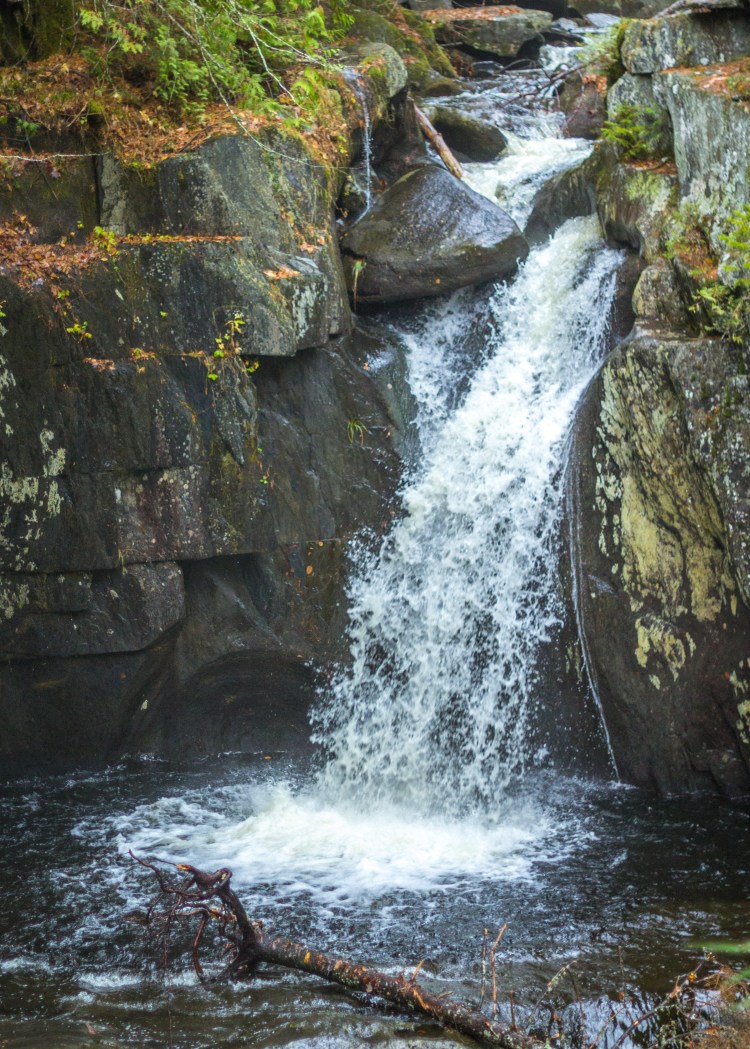
After the water crossings, you’ll be on the AT for a little while, then you’ll find yourself on a 2+ mile adventure up and down and over rocks and tree roots. There are quite a few viewpoints to be explored, which adds mileage and time to the hike – for these miles we were averaging about a mile an hour. These diversions are totally worth it, though – the waterfalls come one right after the other and they are wonderful.
Disclaimer from here forward: I may have the names of these falls messed up. Sorry about that. Perhaps you will just have to go hike this yourself and correct me.
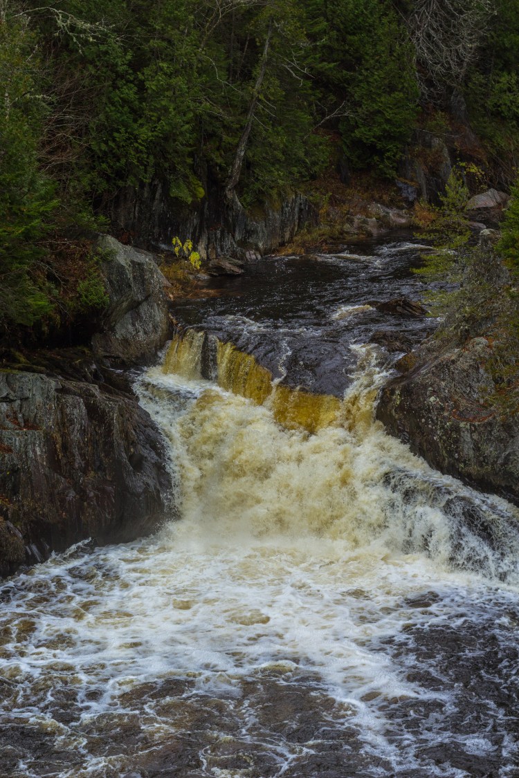

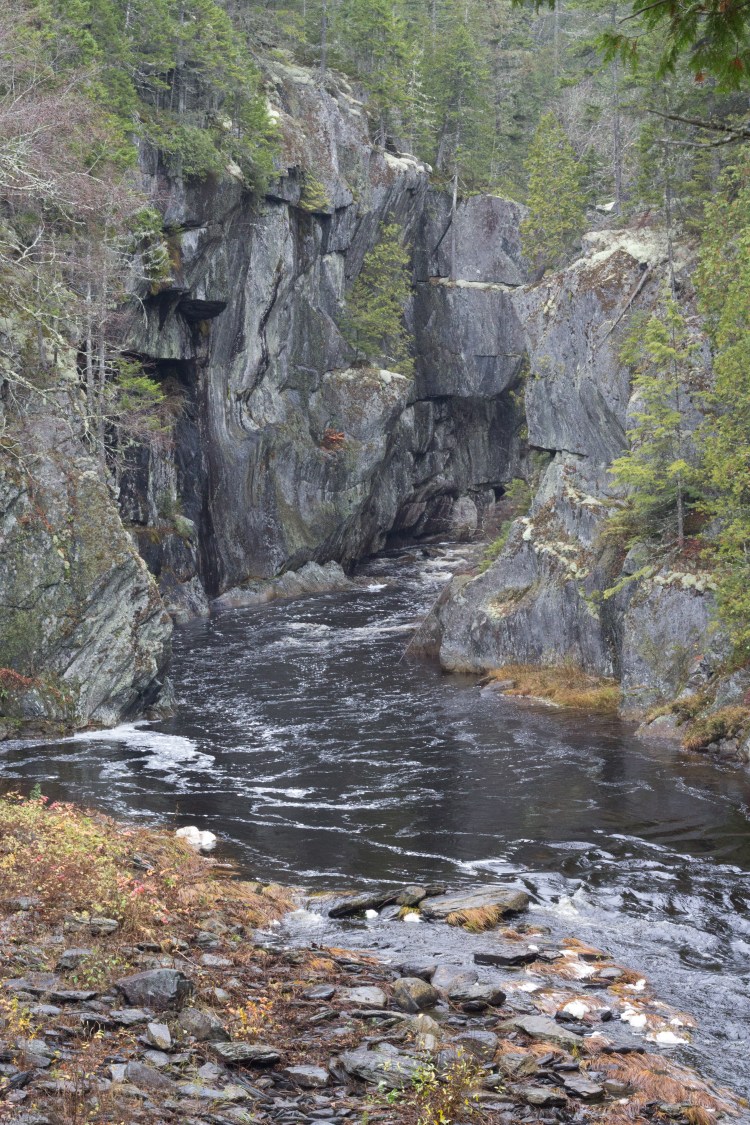
As you reach the end of the first leg of the hike, you’ll come to the Head of the Gulf, where rivers converge and where you can really feel the power of the water. Then, you’ll make a choice which way to come back; either retracing your steps, or taking the Tote Road back to the AT Junction with the Rim trail. I highly recommend this option (since it’s the one we did), as the footing was easier and after all the up and down and making sure to not fall into the canyon on the slippery rocks, it felt nice to just tramp through the woods.
In our case, it was also getting dark, and so getting back to the car and eventually to dinner was on our minds. I chose to put my water shoes on at the first, smaller river crossing, and then do to next mile or so in them until we reached the bigger crossing. My legs were pretty tired by this point (even in on a rainy day its important to drink enough water so you don’t get muscle cramps, like I did), so I took extra care with the river crossings. We were glad for my trekking poles for this crossing, too.
And we didn’t need the headlamps, but another few moments and we would have!
As I finish this post, it’s months since we did this hike (it was in late October 2017), but it still stands out as a fun day spent exploring some incredible terrain. I have heard from others that the black flies and bugs can be brutal during the summer months, so there is some advantage to coming in the late fall, though I’d recommend not waiting as long as we did; most of the leaves were gone, and we kept saying “I’ll bet this is pretty when the foliage is at its peak.”
And for the record, I have done everything but ask a librarian and I still don’t know why it’s called Gulf Hagas.
Thanks for coming along! Let me know in the comments if you have done this hike or plan to!
